I am new to town and therefore, new to the Logan River. I chose to observe a section of the Logan river that runs in front of the Utah Water Research Lab. The following are photos, a sketch and observations I noted while on site.
Photos.
Photos.
|
|
|
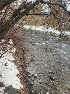
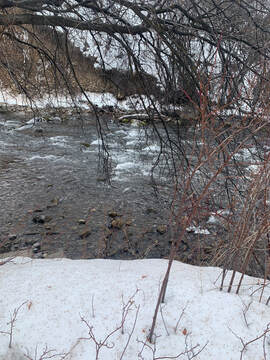
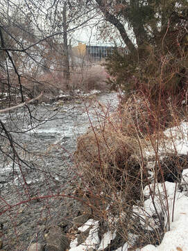
Looking upstream from the Looking at the main riffle section Looking downstream from the
right bank. from the right bank. right bank.
right bank. from the right bank. right bank.
|
Observations.
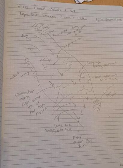
To the left is the sketch from the reach I observed. It is mostly shallow with fast moving, clear water. The river bed is mostly cobbles with a few larger rocks mixed in. There are many willows and overhanging trees along both banks. This section has a narrow floodplain on each side of the river but the UWRL and its' parking lot force the river to be fairly channelized through this section. There is a small woody obstruction on the left bank of the river that has created a more stagnant area of water behind it. The upstream end of the study area was bounded by a sharp curve in the river where the outside bend of the channel is cutting into the hillside. This looks to be an area of sediment input, especially during high flows or large rain events due to the cliff wall being exposed earth and unvegetated. Toward the downstream section of the reach, the channel narrows and the velocity seems to increase. |
