In this assignment, we were provided with five years of survey data from a reach of the Feshie River in Scotland, UK. I imported all five years into ArcMap and completed two change detections (2004-2003 and 2005-2004). I then selected eight areas of detectable geomorphic change from the 2005 to 2004 map overlays. I selected two areas of each of the following: bank erosion, bar development, bed aggregation and bed degradation. The following video outlines the eight areas I selected and my reasoning for selecting them. Below are also the tables from each of the four types of geomorphic changes and screen shots from both change detections completed.
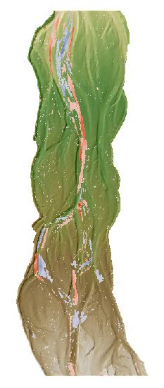
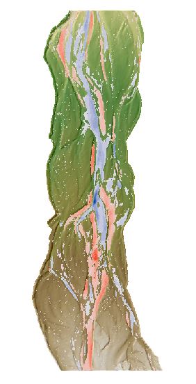
Below are screen shots from the change detection for years 2004-2003 (left) and 2005-2004 (right). The red represents erosion or degradation in the latter year compared to the former year and the blue represents aggradation. The 2005-2004 change detection shows much greater changes in the reach than the change detection from 2004-2003.
|
|
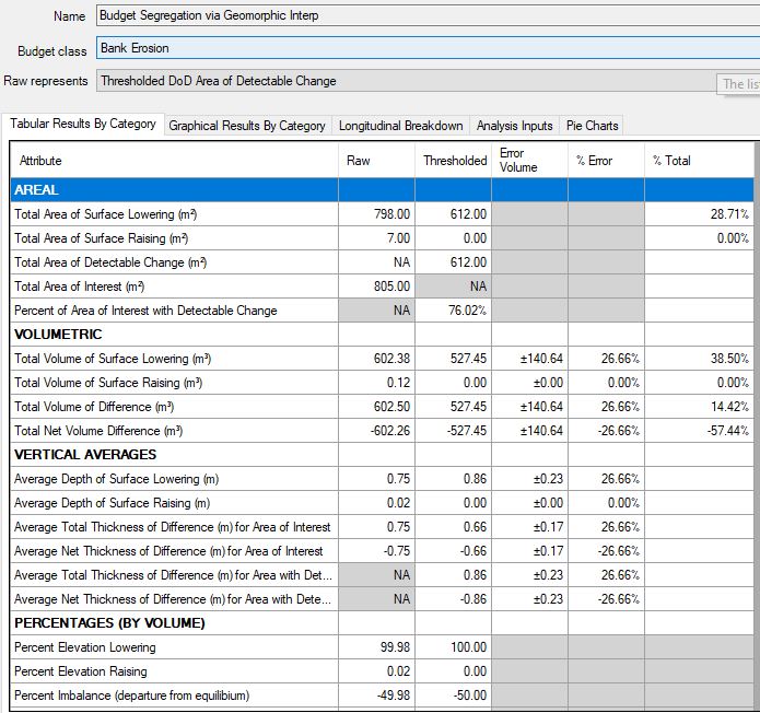
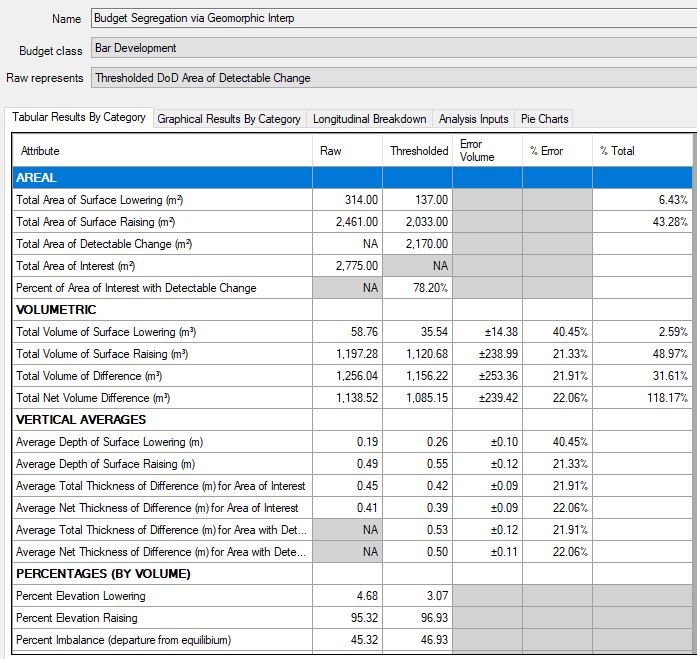
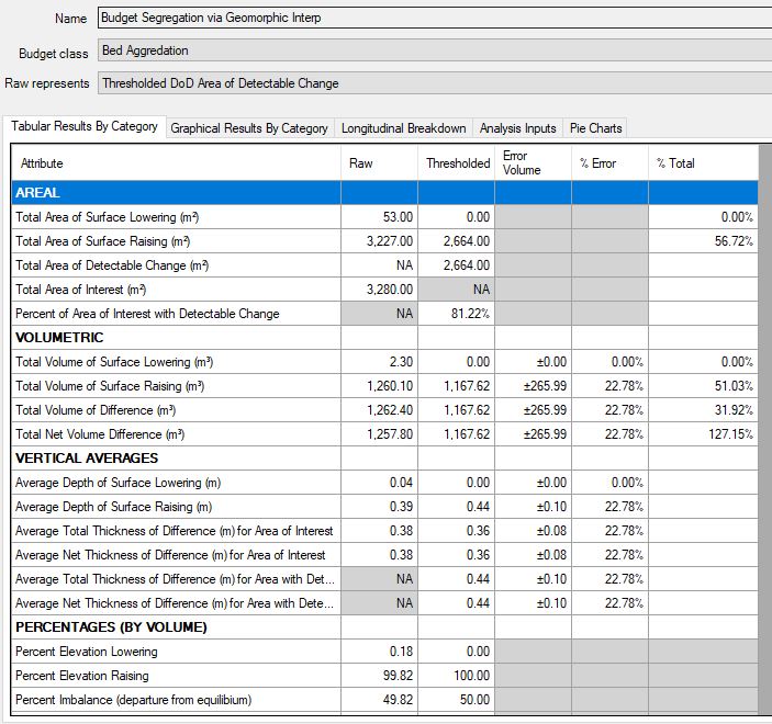
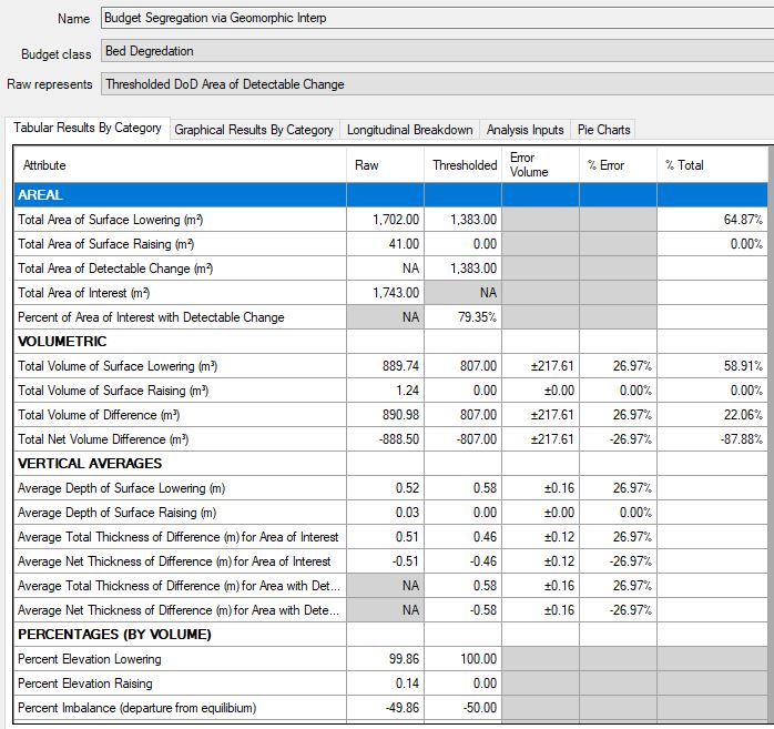
Below are the budget segregation tables for each of the geomorphic changes: (Clockwise starting from the upper left) bank erosion, bar development, bed degradation , and bed aggradation.
|
|
|
|
